We
are now in Tromsø, having made our way here from Svolvær, capital of the Lofoten Islands, from where we
published our last Post (No 4) on 25 June, soon after we arrived. Our progress since leaving Ipswich on 8 May is illustrated on the following overview:

Progress to date from Ipswich
Our
route to Tromsø via the Vesterålen Islands and Senja is shown in more detail below and is the subject
of this Post:

Route from Svolvær (Lofoten Islands)
to Tromsø
On
the evening of our arrival in Svolvær, in the Lofotens, we visited the Lofoten
War Memorial Museum which was being kept open late to accommodate the arrival
of a Hurtigruten coastal steamer. The Museum is privately and passionately
owned. Hundreds of artefacts have been acquired over the last fifty years and
there are many evocative, largely unpublished, WWII photographs on
display. The labelling, as in most
Norwegian museums, was in Norwegian and English – and German.

Lofoten War Memorial Museum, Svolvær
The
town once sprawled across a series of skerries, most of which have now been
filled in to create a reclaimed peninsula.
Many of the concrete buildings in the town centre are not particularly
attractive. Nor is the town quay on which we moored, but at least it was free
and solidly constructed (unlike some). Very different from the picturesque villages
we’ve become used to stopping in.

Svolvær harbour quay at low tide from Island
Drifter’s saloon
The
“Svolvær goat”, clearly visible jutting out of the mountain overlooking the
harbour, provides a supreme rock-climbing challenge for enthusiasts who aim to
scale one of the 40-metre horns and then cross to the other. It was impossible to hold Helen back from
this challenge!

Helen leaps the “Svolvær goat”!
At
the entrance to the harbour there is a statue of a fisherman’s wife poignantly
waving farewell to her husband as he sets off to sea to fish. Fishing has always been a hard and dangerous
occupation. When we were in the
Shetlands two years ago, two fishermen died in the same week while fishing on
separate boats, drowned when they became caught up in their long creel (fishpot) lines. At the time we were surprised, when listening to one of the incidents
on our VHF, that the Coast Guard seemed more concerned with getting someone to
pull up the fishpots than looking for a survivor or floating body. We now know
why.

Statue of fisherman’s wife at harbour
exit, Svolvær
From
Svolvær we made our way north into the Øyhellesund which leads into the
Raftsundet. The latter divides Austvågøya (Lofoten) from Hinnøya (Vesterålen). It can be seen from the chart below that the
Vesterålen
Islands lie to the northeast and north of Austvågøya, the Lofoten chain’s most northern island. The islands are linked to each other and the
mainland to the east by roads, bridges and tunnels, and to the Lofotens by the
E10, or the “Lofoten Highway”.

Vesterålen Islands in
relation to Lofotens and mainland
Vesterålen’s harbours and villages are
more functional and less picturesque than their Lofoten neighbours. It is
populated by smaller and fewer communities, particularly on the west
coast. They have significantly fewer
tourists since the islands are well off the “beaten track”. Campervans are, however, beginning to explore this outer
area.

Vesterålen scenery in the
Raftsundet narrows
The
currents in the Raftsundet, which separates the Lofotens from the Vesterålens, run swiftly, particularly
where it narrows in three locations. It
was therefore essential to time our passage right. We chose to travel through the Øyhellesund Narrows at low tide
when the water was slack because we wanted to visit and stop at the Trollfjord
five miles further on and then catch the next north-going tide. It was shallower than we had
calculated. We ended up with half a
metre under the keel and could clearly see shallow sloping
sandy banks less than 10 metres away on either side. Mike felt a compelling
need for a “strong ship’s coffee” once we were safely through. Fortunately, Percy (our Perkins engine)
behaved!

Approach to the very shallow Øyhellesund
Narrows
To be fair to Percy, he now appears to be working well –
with the odd hiccup. OUR problem is
that, after two months, our nerves are on edge and we imagine that we hear the
revs drop if, for instance, we change our position in the boat – when in fact
they haven’t! During the winter the fuel tanks were emptied and cleaned. A number of the connections in the fuel
system were clearly not put back properly (and are now 18 years old). We’re now
fairly convinced that the problem all along has been air being sucked into the system
causing fuel starvation to the injectors. The system has 64 opportunities for
air to be sucked into it: 8 metal washers,18 rubber washers, 24 jubilee clips
and 14 olives. We’ve ended up checking,
repairing, replacing or modifying most of them using clear tubing to help
identify where leaks were originating.
In the case of the olives and joints in the copper pipes, we glued these
with Loktite since we were initially unable to find appropriate replacements in
Norway. Necessity and all that… Even so, things are still not 100% right,
but it is no longer a major problem (hopefully). Finding an air leak is not easy! When we get back to
Ipswich we’ll review and modify the present system to avoid such problems in
the future.


Percy
Soon
after passing through the Øyhellesund Narrows at the south end of the sound we
turned, as planned, into the Trollfjord.
It is a spectacularly steep and narrow fjord, but only two miles long.
At its end on a wooden quay we met up again with Peter and Jeannette on Passe-Partout.
They’d stayed the night there in solitary splendour in a dream location.

Island Drifter leaving Trollfjord
Mike
and Peter went off fishing in our dinghy and came back with five cod. It’s a
pity that the one Peter is holding in the photo below is the small one they’d
kept for crab bait! The others weighed between 3 and 5lbs. Just right.

Mike and Peter returning from fishing trip
At
1500 hours, as planned, we left in convoy to travel the rest of the Raftsundet
with the north-going tide. Great fun in
the Narrows! At one stage our speed over the ground was more than 9 knots.

Note Boat Speed
Once
out of the sound and into the Hadselfjord we put up the sails and enjoyed a
close reach into wind across to Stokmarknes, a protected harbour on the north
side of the island of Hadseløya. It’s a pity we were sailing into wind otherwise we could have had the mizzen up and got a better photograph of Island
Drifter.

Island Drifter under sail into wind
One
of the reasons for going to Stokmarknes was that the local guidebook
specifically advertised that a washing machine and showers were readily
available for the use of cruisers. Such facilities have not been available in
the Lofotens where we’ve stayed, so Helen and Jeannette were not happy when
they found a notice on the pontoon advising that such facilities were now
“withdrawn”!
While located in very attractive surroundings, Stokmarknes
is clearly a more functional town than its more scenic Lofoten equivalents.

Stokmarknes guest pontoon and
unpretentious town centre
That
evening we assembled on Passe-Partout and Jeannette cooked an excellent
cod and orange soup. Helen has the recipe and we have since tried it out with great success.
Our main reason for visiting Stokmarknes was to see the Hurtigruten
Museum. As one would expect, it was very professionally presented and portrayed
the history of the coastal steamer since its inception in Stokmarknes in 1893. Today their 11 ships operate 24 hours a day,
all year round. They carry mail, freight and passengers, including an
increasing number of tourists looking for a scenic experience. The ships call
into 35 ports in the 2,500 miles between Kirkenes in the far north and Bergen
in the south. They are a vital link in Norway’s transport system.

Hurtigruten Bridge exhibit
Peter
and Jeannette left next morning to go north up the Sortlandsundet, the inner
lead, to Sortland, the commercial centre of the Vesterålens. They
have since told us that, like the unicorn, the advertised washing machine did
not exist there either! We, meanwhile,
pootled 3 miles west to a delightful anchorage on the east side of Holmsnesøy islet, part of the island of
Langøya. On the islet was one of the many small white coral sand beaches we were to see in this area. These are a reminder that the land-mass of Norway was once at the Equator.

Holmsnesøy anchorage
We
spent the afternoon in the cockpit in the sun before going ashore by dinghy to
explore the surrounding islets. There we discovered patches of wild
cloudberries. These berries are highly
prized and considered a great delicacy.
Locations are jealously guarded in certain areas and scrumpers are known
to have been prosecuted! Warm
cloudberry jam with ice cream is fantastic.

Wild cloudberry on Holmsnesøy
Next
morning, given the excellent weather that appeared to be holding, we decided to
continue north outside the skjægård along the exposed western coast of Langøya, rather than through the
sheltered inner leads to the east.
Late afternoon we pulled into Hovden, a small fishing village on the
northern tip of Langøya. We were the first yacht to arrive
this year. Only four yachts visited last year! It is not surprising therefore
that we were of interest to some of the local inhabitants of this
scattered fishing and holiday hamlet.

Hovden pontoon showing rocky
approach to harbour in background
approach to harbour in background
While
looking around the hamlet, we came across a family whose children were
enthusiastically trying to sell the plaice that their grandfather had netted that
day. We bought two and had them for
supper before going back out to another house for dessert of coffee and
waffles. Again, a young entrepreneur
was making some pocket money!

Fresh fish for
sale!
The
next day a local angler, with whom we had previously chatted, brought us a 5lb
cod which he’d just caught and was, he explained, surplus to his requirements.
For supper we used a local recipe for curried cod which was excellent.
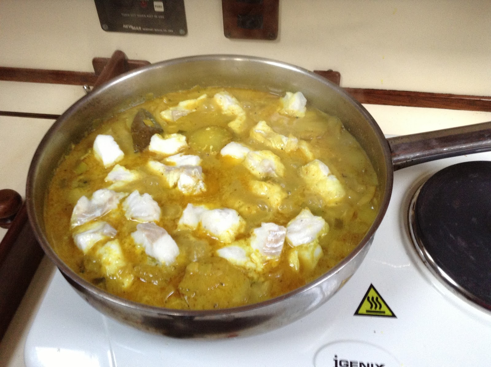
Curried fresh cod for supper
Later
we joined Ulf Hansen, a local ex-fisherman, now a high school biology teacher
in Trondheim, whom we’d got to know, and his family for a drink and nibbles on
their patio. We had in particular been
invited to see his old family photos of the hamlet dating from 1895. They were fascinating. We were introduced to
the Norwegian custom of eating strands of dried cod (the Norwegian equivalent
of biltong) as an accompaniment to beer.
An acquired taste but very moreish once acquired. As our host pointed out, much better for one
than crisps. Seabirds nest in every nook and cranny that they
can find, including the roof of Ulf’s summer house.

Chicks enjoying the evening sun on
Ulf’s summer house roof
After
a most enjoyable evening, Ulf and his stepdaughter Siv walked us back to point
out the best vantage point for viewing the midnight sun.

A rare photograph
of us!
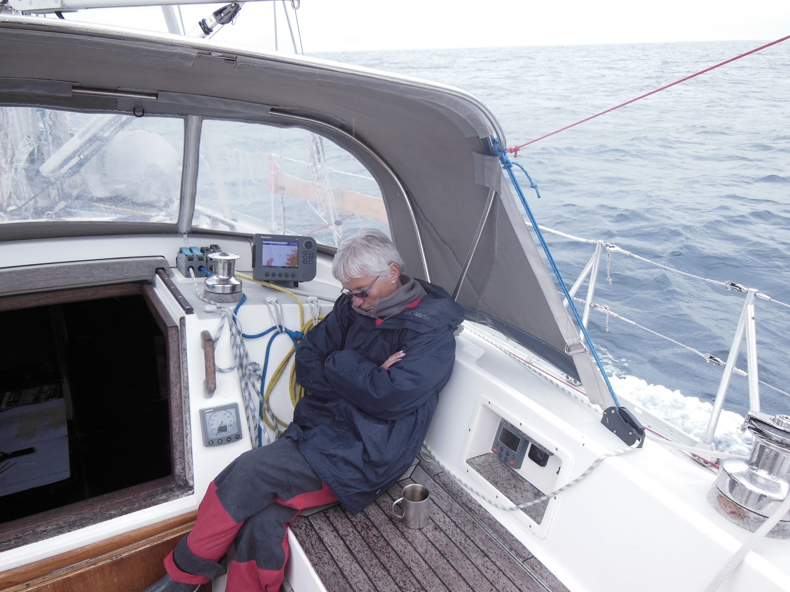
We’ve
struggled to get a good sighting and photograph of the Midnight Sun. Apart from anything else, we need a more
sophisticated camera. Initially,
however, we failed to recognise the effects of time zones! At 15 degrees east, “midnight” here is an
hour earlier than GMT and since local time is two hours ahead of GMT, the sun
does not reach its nadir until 0100 local time. When first watching at “midnight” we wondered why the sun was
still sinking!

Midnight Sun from Hovden
We
eventually got to bed at 3 a.m. With 24
hours of good daylight, the time of day becomes less important. We were up four hours later at 7 a.m. We’d previously been invited to use an
industrial washing machine, tumble dryer and the shower provided for employees
in a corner of the rickety old fish-processing shed perched above the water on
stilts. Unlike the shed’s exterior, the facilities inside were in immaculate
condition and we made full use of them.
Before leaving we fortunately remembered to collect our THIRD load of
washing from the dryer.

Helen outside laundry in dilapidated
fish-processing shed in Hovden
It
took four hours from Hovden to Stø, which clings to the
northern tip of Langøya. We planned to use the harbour as a springboard for crossing the
40-mile stretch of open water to Andenes at the top of Andøya, the next and
last island in the Vesterålen group. The weather can change very quickly so we
wanted to be well positioned. Like Hovden, Stø was another unpretentious working fishing
harbour. The five-hour round trip to the ghost village of Nyksund, initially
over the 517m Sørkulen peninsula and back along the shore, is known as the
Queen’s Walk. It’s named after a hike
taken by Norway’s Queen Sonja in 1994. Today the abandoned village of Nyksund
has been restored with rorbu accommodation for visitors and a handful of local
people have moved back.
The other attraction (for campervan owners) was that the campsite on the edge of the village provided a clear view of the midnight sun. Mike ruined the evening for an athletic couple, who had climbed the steep headland to get an even better view, by informing that they had descended an hour early!
The other attraction (for campervan owners) was that the campsite on the edge of the village provided a clear view of the midnight sun. Mike ruined the evening for an athletic couple, who had climbed the steep headland to get an even better view, by informing that they had descended an hour early!

Stø harbour with colourful inshore
fishing fleet in background
As
it happened, we ended up motor-sailing in flat seas from Stø to Andenes. It is the
principal port and town (pop. 4200) of Andøya and Vesterålen’s most northern
point and largest fishing centre by far.
Only
15 miles west of Andøya the continental shelf plummets rapidly from 100 to
2,500 metres. The deep cold waters attract squid including, we read, some
gigantic ones. These in turn attract
squid-loving sperm whales. Unsurprisingly, an active whale-watching safari
industry has developed. They guarantee a sighting or “your money back”. At £100 per person we gave this trip a miss.
It helped that we’d seen whales before and actually had one come up 50 metres
in front of us on our way to Andenes.

One of the whale safari boats in Andenes
We
had one of our better sails, poled out and with all three sails up, from
Andenes to Hamn in Senja, Norway’s second largest island, just off the mainland.

Running downwind with all sails up
It
was a pleasant and relaxing sail with the wind behind us.
Helen enjoys a crackingly good sail to Senja!
Towards
the end of the crossing to Senja, we wove our way through the skerries of
Bergsfjord into Hamn. Contrary to our normal practice, we chose a very small,
sophisticated resort constructed on the site of a former fishing harbour. The
rorbu accommodation is painted granite grey to blend in with the surroundings –
unlike the bright colours normally used.
Hamn is a delightful, small holiday complex with an upmarket restaurant
and facilities. These include a sauna,
a hot-tub in an old fishing smack, outstanding showers (towels provided),
laundry and wifi – all included in a modest mooring fee. The resort provides diving, fishing, boating and kayaking for the guests. We actually stayed the following day since
we became hooked on the luxuries, which to date we’ve not been accustomed to!
Interestingly, nearby is the small dam used for what is claimed to be the
world’s first hydro-electric generating plant.

Hamn holiday resort, Senja
We
travelled 30 miles next day to the small working village of Botnhavn on the
northeast coast of Senja – a good location from which to reach Tromsø, our most
northerly destination.
Our passage to Botnhavn from Hamn took us along the north and northwest coasts of the island of Senja. These coasts directly face the Arctic Ocean and comprise steep headlands, deep fjords and sharp mountain peaks that rise vertically from the ocean. Few people live along the coastline although there are some small hamlets tucked into the fjords. Once into the Malangen Sound between Senja and Kvaløya to the north, the waters and coastline become significantly better protected. As it was, we motored all day in flat water.

Botnhavn harbour does not see a need to cater for yachts. Local fishermen were, however, most helpful making space available on a pontoon and taking our lines. We can’t imagine the Whitby fishermen doing the same. They are more accustomed to cutting lines…
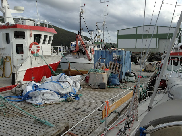
Our passage to Botnhavn from Hamn took us along the north and northwest coasts of the island of Senja. These coasts directly face the Arctic Ocean and comprise steep headlands, deep fjords and sharp mountain peaks that rise vertically from the ocean. Few people live along the coastline although there are some small hamlets tucked into the fjords. Once into the Malangen Sound between Senja and Kvaløya to the north, the waters and coastline become significantly better protected. As it was, we motored all day in flat water.

Dramatic coastline of Senja, bordering Arctic Ocean
Botnhavn harbour does not see a need to cater for yachts. Local fishermen were, however, most helpful making space available on a pontoon and taking our lines. We can’t imagine the Whitby fishermen doing the same. They are more accustomed to cutting lines…
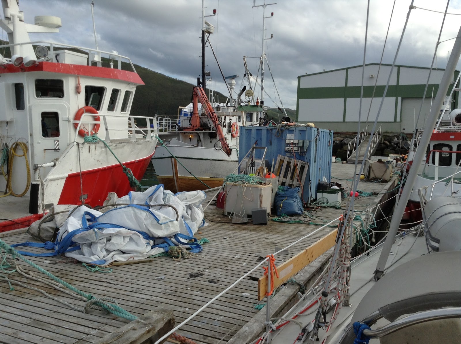
Working fishmen's quay, Botnhavn

The 25-mile sail from Botnhavn to Tromsø went well. The weather was good and we caught the tides right in both the Rystraum Narrows and Tromsø sound itself. On arrival we bought a kilo of prawns and had lunch.

Fresh prawns for lunch in Tromsø
We'll spend a day or two here before turning south and exploring the inner leads and fjords down to Bodø. From there we'll push on, weather permitting, to Ipswich. We expect to get back by early August.
Wonderful looking forward to seeing you home safe and well.
ReplyDeletexxx
Lovely flowing Blog and excellent pictures (especially that of the intrepid authors lit by the midnight sun) before heading South to Ipswitch.
ReplyDeleteAfter Glutfisk! - perhaps its time for an antidote of coconuts in the Caribbean :-) Grahame & Monica (Bermuda)
Botnhamn:Takk for besøke her vellkommen igjenn.
ReplyDeleteHilsen Spayk,Einar,Torhild og katten Sol
Botnhamn Senja:God tur vidre hilsen Spayk,Einar,Torhild og katten Sol
ReplyDeleteVery nicely illustrated account. Thanks for sharing this.
ReplyDelete